Directions to Midtown Crossing

Located at the intersection of everything Omaha
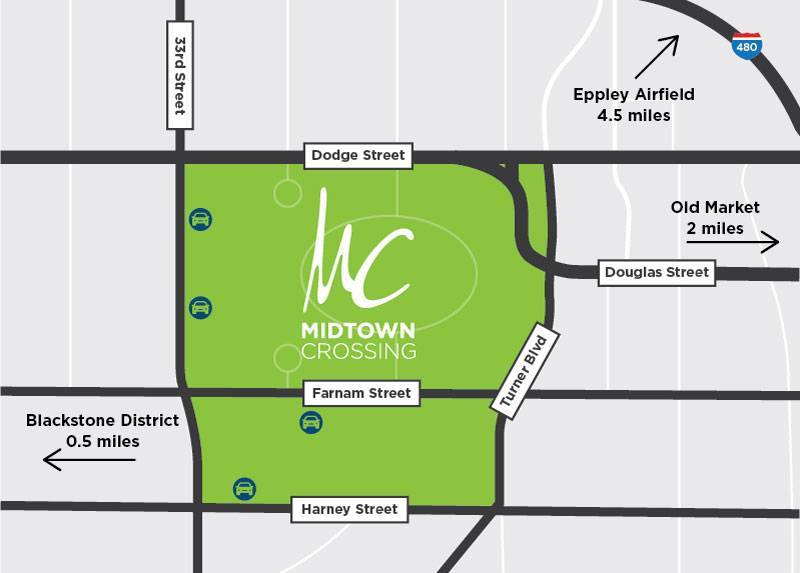
Midtown Crossing is centrally located in the heart of midtown Omaha, just off I-480 and minutes from downtown, Eppley Airfield, UNMC and Creighton University. Neighborhood boundaries are Dodge Street to the north, Harney Street to the south, 33rd Street to the west and Turner Boulevard to the east.
Conveniently-served by all major modes of transportation, Midtown Crossing is located on both the Metro and ORBT bus lines, hosts a Heartland B-cycle b-station, and serves bikers, joggers, walkers and skaters along the nearby and highly accessible bike trail system. Electric scooters are readily available along nearby streets. Plans are underway for a Modern Streetcar to run along the Farnam corridor from midtown Omaha to downtown, set to begin operation in 2026.

PARKING
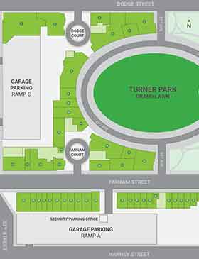
Midtown Crossing offers three hours free parking with retailer validation, and metered street parking.

DIRECTORY MAP
Navigate your way through Omaha’s favorite walkable neighborhood, including local businesses, Turner Park & parking.

FREQUENTLY ASKED QUESTIONS
Learn more about Midtown Crossing, including history, accessibility, pet-friendly offerings and more.


